Category:Wing Fai Centre
Jump to navigation
Jump to search
| Object location | | View all coordinates using: OpenStreetMap |
|---|
Public housing estate in Fanling, Hong Kong  | |||||
| Upload media | |||||
| Instance of |
| ||||
|---|---|---|---|---|---|
| Location |
| ||||
 | |||||
Subcategories
This category has only the following subcategory.
W
Media in category "Wing Fai Centre"
The following 11 files are in this category, out of 11 total.
-
 Alliance Primary School Sheung Shui in March 2024.jpg 3,591 × 2,693; 3.45 MB
-
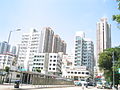 Fanling3.jpg 1,600 × 1,200; 580 KB
-
 HK AlliancePrimarySchoolSheungShui.JPG 2,848 × 2,136; 1.52 MB
-
 HK WingFaiCentre AlliancePrimarySchoolSheungShui.JPG 2,848 × 2,136; 2.64 MB
-
 Shops in Wing Fai Centre.jpg 6,000 × 4,000; 14.32 MB
-
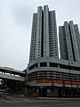
 Wing Fai Centre 2015.jpg 2,272 × 1,692; 2.61 MB
-
 Wing Fai Centre Car Park.jpg 5,959 × 3,941; 13.08 MB
-
 Wing Fai Centre playground.jpg 6,000 × 4,000; 14.18 MB
-
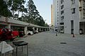
 Wing Fai Centre plaza.jpg 6,000 × 4,000; 13.62 MB
-
 Wing Fai Centre shopping mall.JPG 3,648 × 2,736; 4.24 MB
-
 WingFaiCentre.jpg 480 × 640; 41 KB


